
Texas
Guadalupe Peak
$60
Color — Black
Made to order — ships in 1–4 business days. Shipping & returns
Details
- 12 × 18 inches
- Printed on 98 lb (160 gsm) archival cotton rag paper
- Drawn using precision technical pens and archival inks
- Signed and dated on the back
- Ships flat, carefully protected and ready to frame
Each map begins with elevation data and is drawn by a pen plotter in our Vermont studio. The result merges mechanical precision with the organic texture and imperfections of real ink on paper.
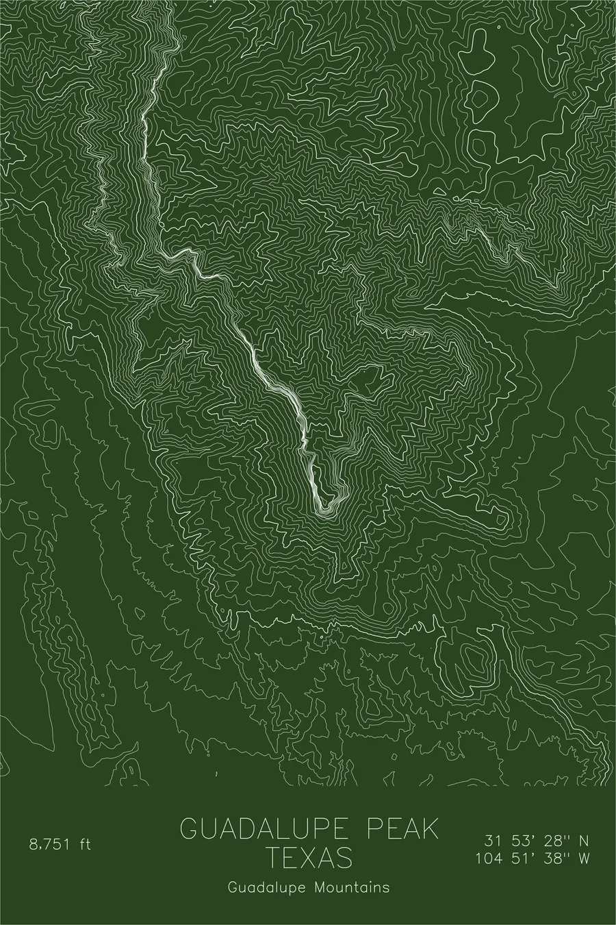
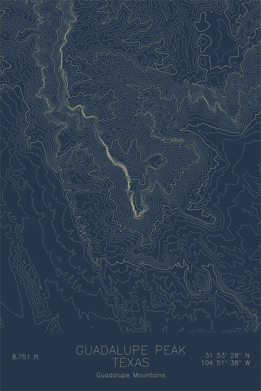
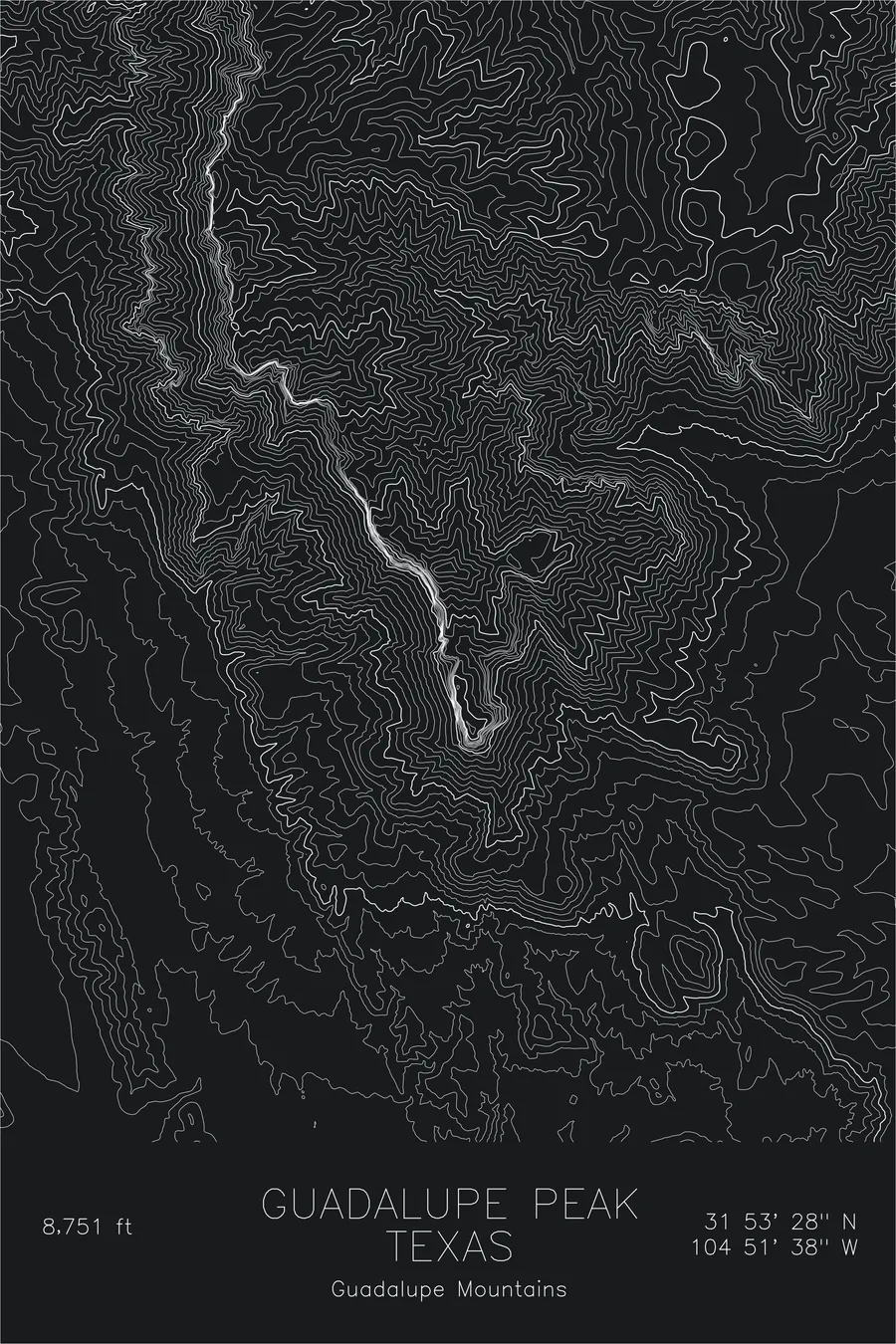
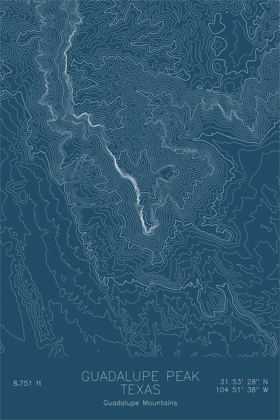
Guadalupe Peak rises 8,751 feet above the Chihuahuan Desert, the highest point in Texas and the exposed spine of an ancient Permian reef. The Capitan Reef formed at the edge of a shallow tropical sea roughly 260 million years ago, and the limestone that built it now tilts skyward as the Guadalupe Mountains: a fossil barrier reef turned desert escarpment.
This map traces the dramatic topography of the peak and its surroundings. The contour lines compress sharply along the western escarpment, where the mountain drops over 3,000 feet to the salt flats below. The gentler eastern slopes and the deep cuts of McKittrick Canyon reveal the layered geology that makes this one of the most geologically significant summits in North America.
Location Details
Location
Guadalupe Peak
Range
Guadalupe Mountains
Region
Southwest
Elevation
8,751 ft / 2,667 m
Coordinates
31.8912, -104.8605
Type
peak
Highest point in Texas, the ancient reef summit of an inland sea
Off the Screen


Real-life examples in the selected colorway
More Maps


