

Hawaii
Mauna Kea
$60
Color — Navy
Made to order — ships in 1–4 business days. Shipping & returns
Details
- 12 × 18 inches
- Printed on 98 lb (160 gsm) archival cotton rag paper
- Drawn using precision technical pens and archival inks
- Signed and dated on the back
- Ships flat, carefully protected and ready to frame
Each map begins with elevation data and is drawn by a pen plotter in our Vermont studio. The result merges mechanical precision with the organic texture and imperfections of real ink on paper.
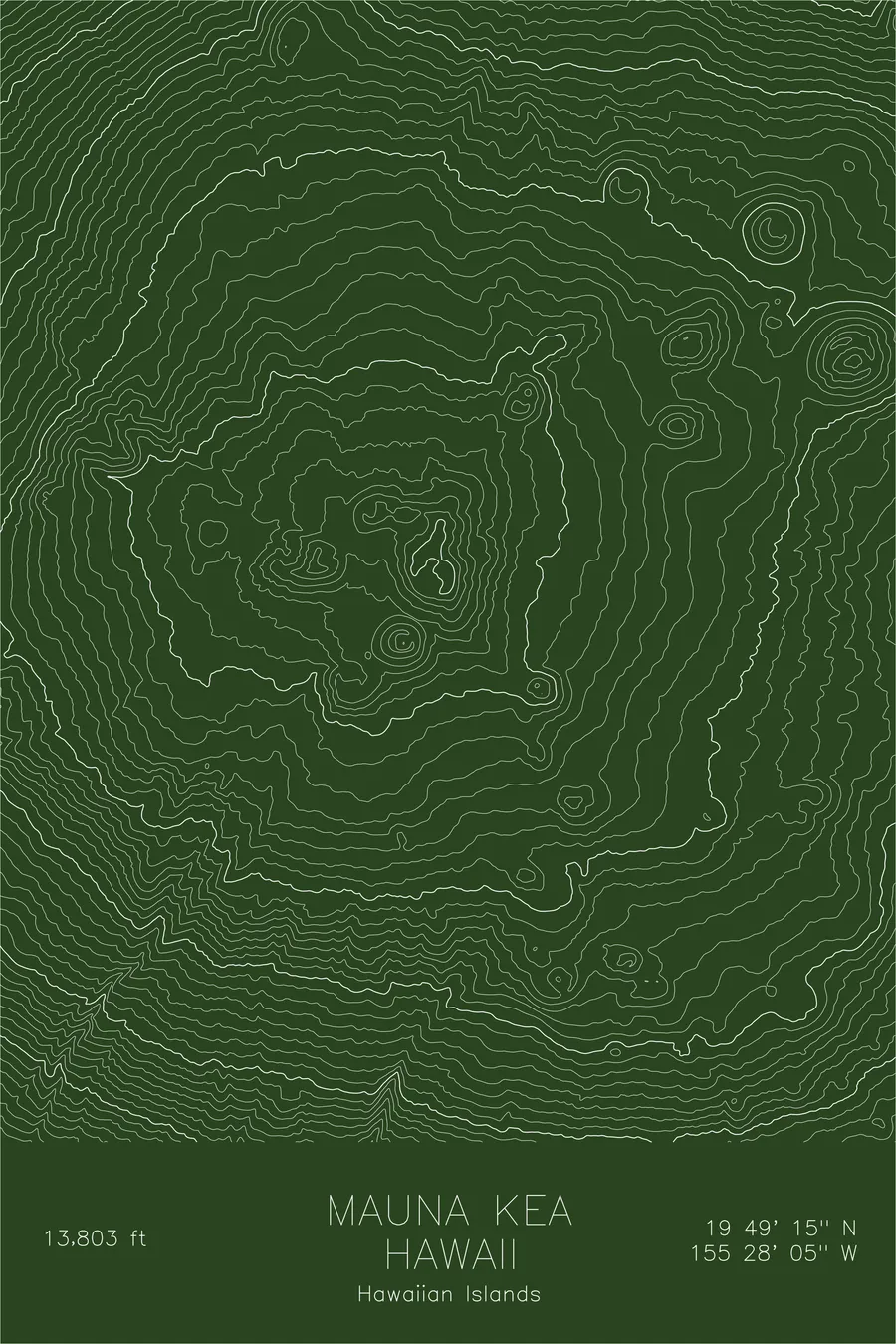
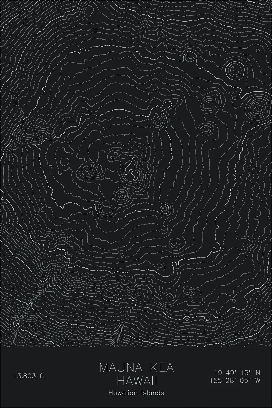
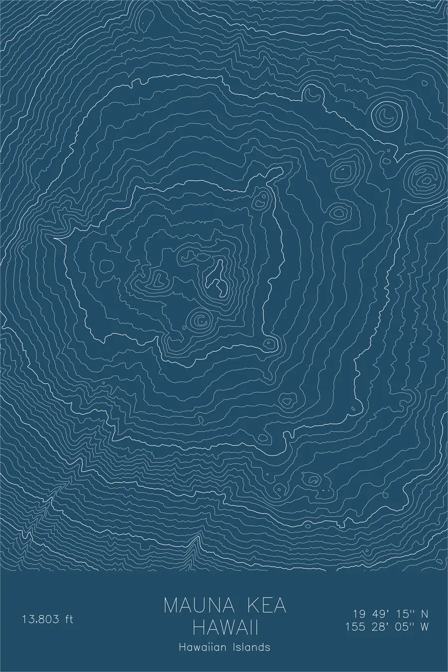
Mauna Kea rises 13,803 feet above sea level, but that figure dramatically understates the mountain. Measured from its base on the ocean floor, it exceeds 33,000 feet, taller than Everest by any structural measure. This dormant shield volcano last erupted roughly 4,500 years ago, and its summit is now home to the world’s premier astronomical observatory complex, chosen for the dry, stable air above nearly forty percent of Earth’s atmosphere.
This map traces the broad, gentle slopes that define shield volcano topography. The contour lines spread wide and even across the flanks, reflecting the fluid basaltic lava flows that built the mountain layer by layer. Near the summit, cinder cones punctuate the surface: small, steep-sided mounds that appear as tight concentric circles amid the otherwise gradual terrain, remnants of the mountain’s final eruptive phase.
Location Details
Location
Mauna Kea
Range
Hawaiian Islands
Region
Hawaii
Elevation
13,803 ft / 4,207 m
Coordinates
19.8207, -155.4680
Type
peak
Volcano. Tallest mountain on Earth measured from its oceanic base: over 33,000 feet from seafloor to summit
Off the Screen


Real-life examples in the selected colorway
More Maps


