

Nepal / China
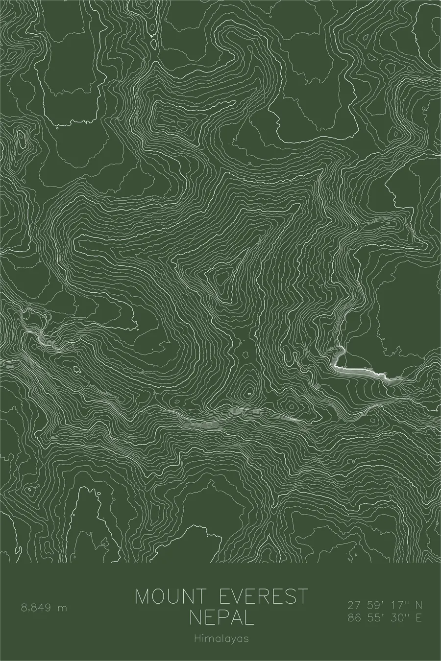
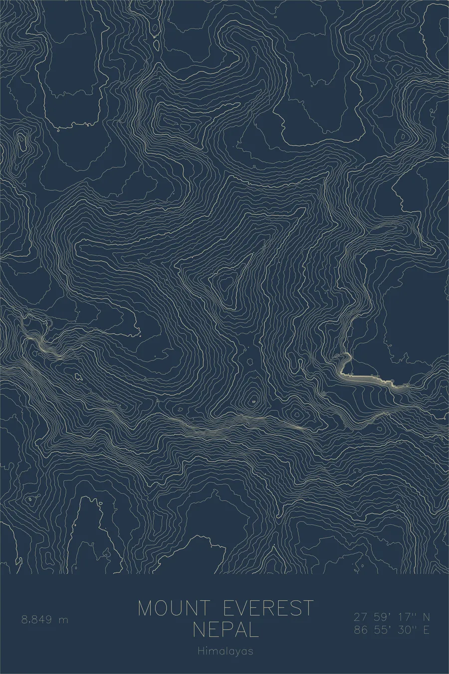
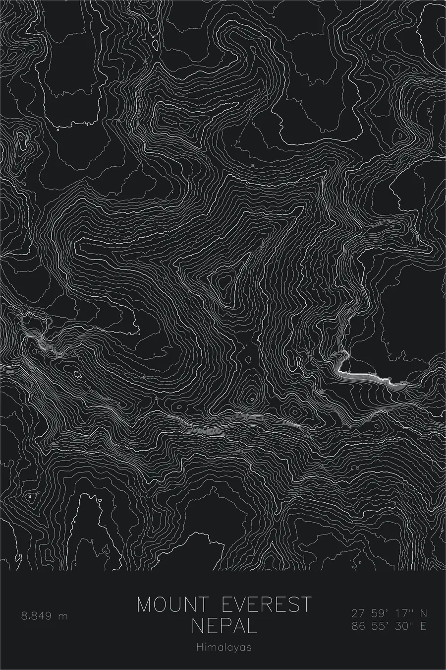
Mount Everest
$60
Color — Blue
Made to order — ships in 1–4 business days. Shipping & returns
Details
- 12 × 18 inches
- Printed on 98 lb (160 gsm) archival cotton rag paper
- Drawn using precision technical pens and archival inks
- Signed and dated on the back
- Ships flat, carefully protected and ready to frame
Each map begins with elevation data and is drawn by a pen plotter in our Vermont studio. The result merges mechanical precision with the organic texture and imperfections of real ink on paper.
Mount Everest stands at 29,032 feet, the highest point on the surface of the Earth. Known as Sagarmatha in Nepal and Chomolungma in Tibet, it rises along the border of the two countries at the crest of the Great Himalayan Range. The mountain was first summited in 1953 by Tenzing Norgay and Edmund Hillary, and it remains the defining objective in high-altitude mountaineering.
This map reveals the massive scale of Everest’s topographic footprint. The contour lines trace the three great ridges that define the mountain’s structure: the Southeast Ridge carrying the standard route from Nepal, the North Ridge rising from the Tibetan plateau, and the West Ridge connecting to the Khumbu headwall. Between them, the contours compress into the steep faces that have challenged climbers for over a century. The Khumbu Glacier and its icefall appear as a flattening of contours at the mountain’s base, while the surrounding peaks of Lhotse, Nuptse, and Changtse crowd the map with their own dense contour signatures, reinforcing that Everest sits not in isolation but at the center of the greatest concentration of high terrain on the planet.
Location Details
Location
Mount Everest
Range
Himalayas
Region
Himalayas
Elevation
29,032 ft / 8,849 m
Coordinates
27.9881, 86.9250
Type
peak
Highest peak on Earth
Off the Screen


Real-life examples in the selected colorway
More Maps


