
Utah
Zion National Park
$60
Color — White
Made to order — ships in 1–4 business days. Shipping & returns
Details
- 12 × 18 inches
- Printed on 98 lb (160 gsm) archival cotton rag paper
- Drawn using precision technical pens and archival inks
- Signed and dated on the back
- Ships flat, carefully protected and ready to frame
Each map begins with elevation data and is drawn by a pen plotter in our Vermont studio. The result merges mechanical precision with the organic texture and imperfections of real ink on paper.
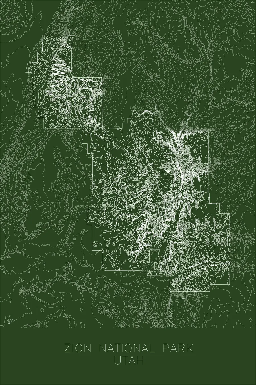
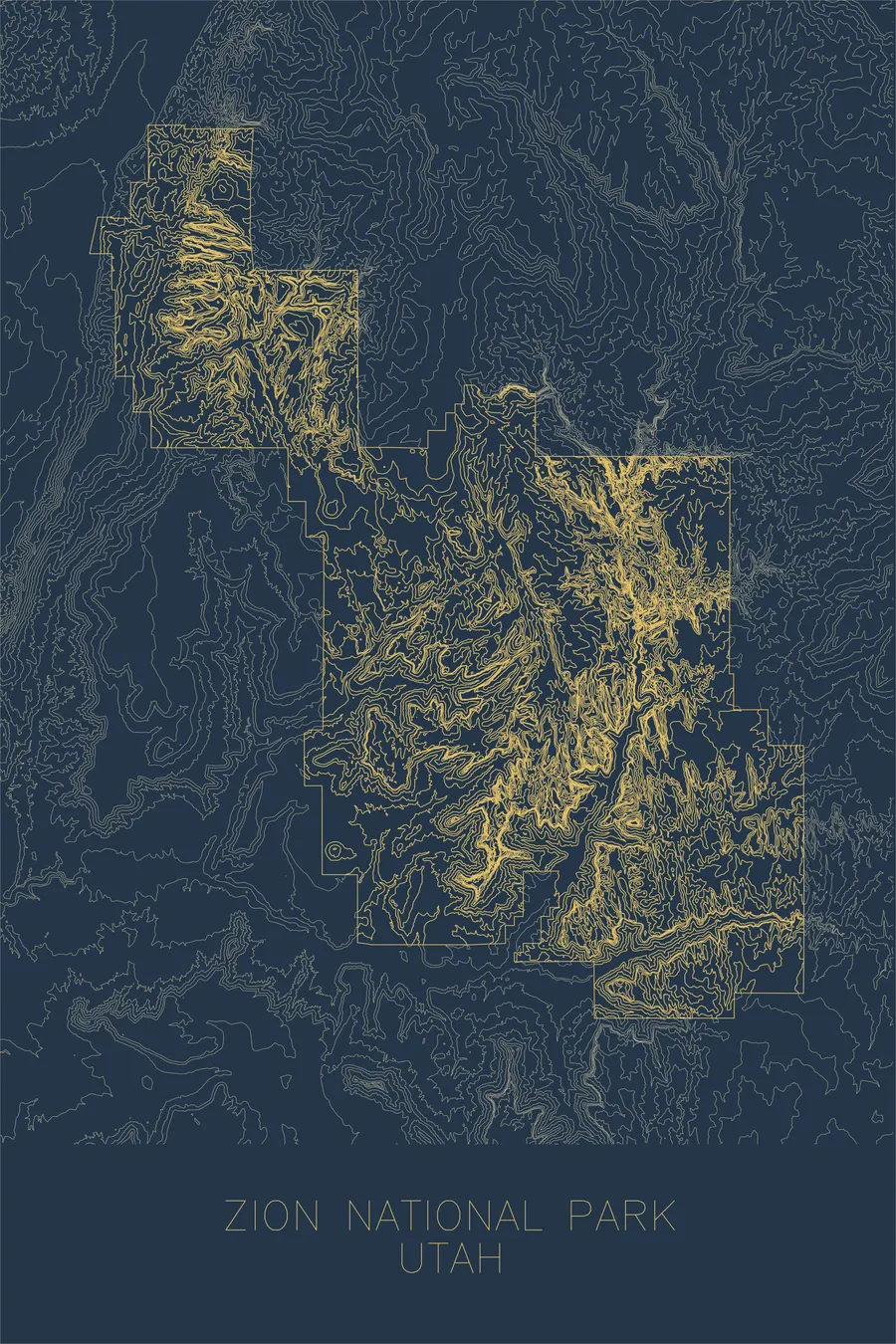
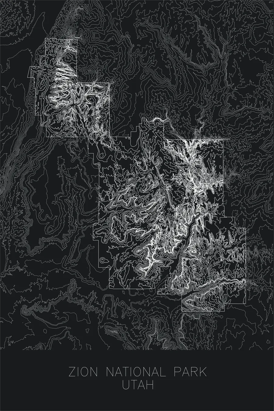
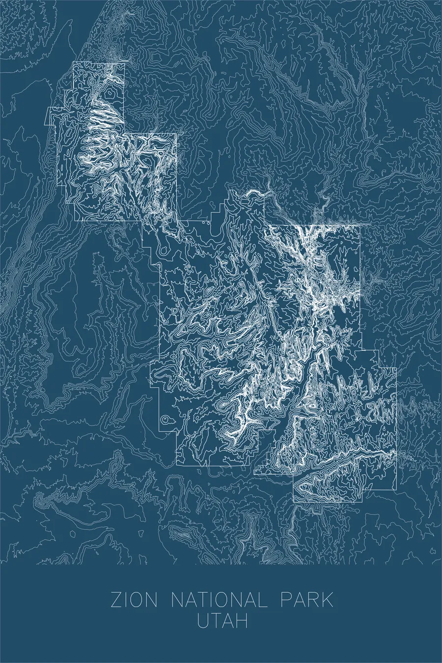
Zion National Park covers 229 square miles of southwestern Utah, where the Virgin River and its tributaries have carved a labyrinth of deep, narrow canyons through layers of Navajo Sandstone. The Zion Canyon gorge reaches depths of nearly 2,000 feet, its sheer walls of cream and vermillion sandstone rising on either side of the river. The park spans an elevation range from 3,666 feet at Coalpits Wash to 8,726 feet at Horse Ranch Mountain, crossing five distinct life zones in the process.
This map traces the extraordinary vertical relief that defines Zion — the contour lines stack tightly along the canyon walls where cliffs drop hundreds of feet in near-vertical faces, then spread apart across the mesa tops and plateaus above. The Great White Throne, Angels Landing, and the towering walls of the Narrows all emerge as dense compressions of line, while the broad Kolob Terrace to the northwest opens into gentler terrain. It is a landscape carved by water into stone, and the map reads as a record of that relentless process.
Location Details
Location
Zion National Park
Region
Rocky Mountains
Elevation
8,726 ft / 2,660 m
Coordinates
37.2982, -113.0263
Type
national park
Utah's first national park, home to one of the deepest and most spectacular slot canyons in the world
Off the Screen


Real-life examples in the selected colorway
More Maps


